Application description

This application is a navigation assistant which provides you useful information about all the airports located around you (60Nm range max). Directly on your watch, with the GPS information, this application helps you fly to airports around you, and helps you contact them by displaying its radio communication frequencies. With an active internet connection, get also the current and forecast meteorological information and a moving land map (powered by MAPBOX).

Features

Navigation assitant

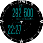
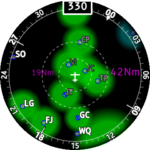
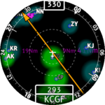
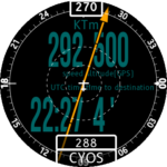
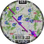
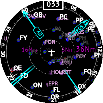
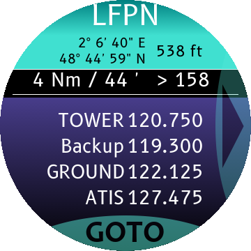
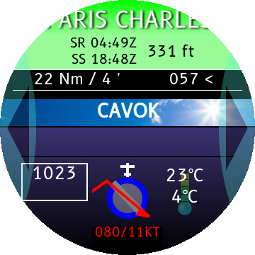
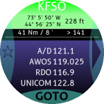
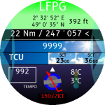
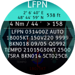
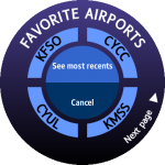
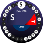
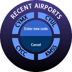
On the main screen, get the flight parameters or major navigation data about the airports and the navaids (VOR, NDB) located near your current position. Different ranges are available by turning the bezel of the watch.

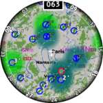
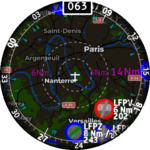
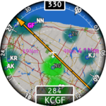
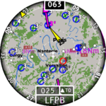
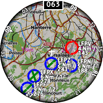
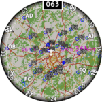
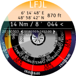
If you have a Galaxy Watch running Tizen v4 or more, you can display a moving land map. Define yourself the details of this land map using the settings menu of the app.

The GOTO function focuses on the airport of your choice and helps you keep the correct heading to the destination.

Full HSI helps you follow your course.

Estimated time to destination is also provided when the GOTO is on.

The RMI function can manage up to 2 pointers. Display one or two pointers as you want by selecting the navaids.

The RMI function can be disabled with the settings menu.

Select the course to any navaid with the new graphical course selection page. From/To sectors are visible. The route is clearly displayed along the current aircraft relative position and heading.

Tap any airport visible on the navigation app and get all the data you need in one page: position, altitude, distance from you, bearing. Known communication frequencies scroll automatically to give you the way to contact the airport simply.

Get also the airport name (scrolling name), the sunrise and sunset times for today.

Land map

This feature works only with Tizen v4 or above.

With a permanent internet connection, the application can display a moving land map! This land map is not stored locally in your watch memory but it is provided dynamically by Mapbox services (see https://www.mapbox.com).

Use the settings menu to configure the land map and choose what type of items you want to see.

Meteorological data

If your watch has an internet connection, the application gives you a clear decoded version of the latest METAR.

Read also the weather forecast. TAF messages have never been so easy to read with the new TAF-on-WHEEL® display. Turn the bezel of your watch to read the time range of the TAF message hour per hour.

Use also on-ground for your flight preparation

You can also get all this data for any airport of your geographical region (depends on the loaded maps). No need to be in flight at 60Nm of an airport to get information about it. You simply have to enter its ICAO code! The application contains a smart keyboard, a list of favorite airports and recent ones to accelerate the access to the info you want.

Demo

Release notes

Latest news

Google Play issues Some users are experiencing problems when downloading the PgW Metar’N’Taf app or the PgW Navigation App for Wear OS. You may have the following error message: ERRORError…

PgW Navigation available soon for Wear OS

Dear Pilots, The development of the Wear OS version of the famous app PgW Navigation is still in progress but it should end soon. Then will start the testing phase.…

PgW Navigation App – v3.0.0 now available

Dear pilots, I’m glad to announce the release of this new version of the PgW Navigation App on the Galaxy Store today. Many new features have been added. Check them…

PgW Navigation App – v2.0.3 now released

Dear pilots, The version 2.0.3 of PgW Navigation App is released today on the Galaxy Store. It solves the following major issue: Map data download is not working on Tizen…